DroneCAN Magnetometer Array
ArduPilot can be used to create a multiple magnetomer array using DroneCAN compasses. This could be useful as a suspended device for geophysical surveys or other uses.
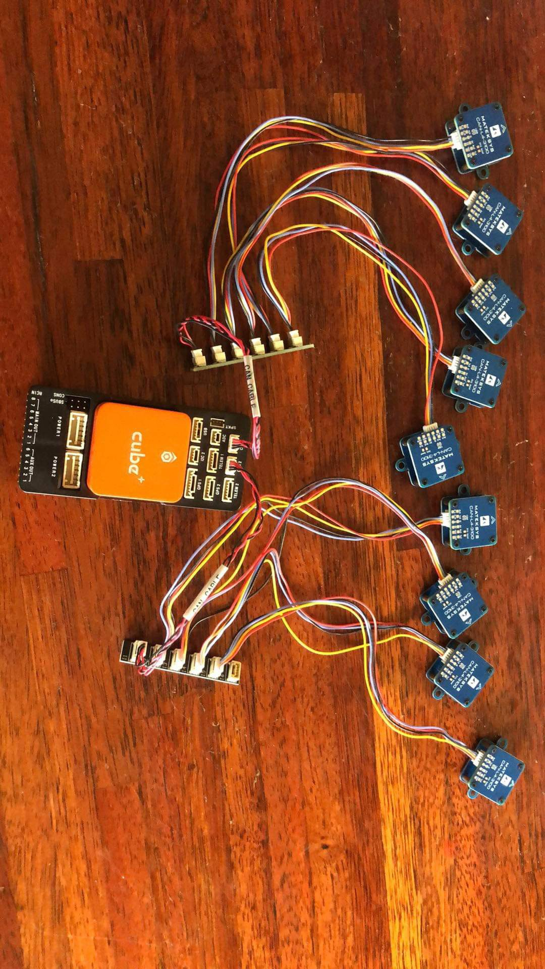
An ArduPilot autopilot (used only for the array logging, not for vehicle control) could support many DroneCAN compasses as shown below:
And could be suspended below a vehicle as shown below:
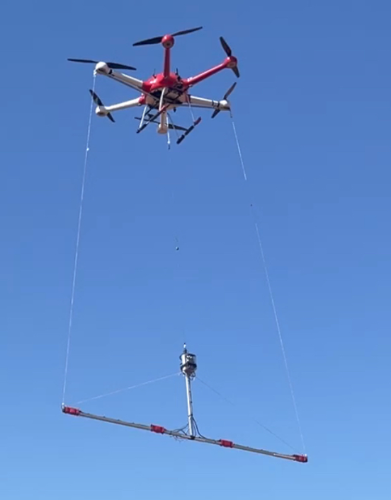
image courtesy of AerialVision
Each compass would have its raw x/y/z field readings logged by the MAGH message.
This capability is not included by default and would have to be included in a custom build for the autopilot using the Custom Firmware Build Server and enabling the “DroneCAN HiRes compasses for survey logging” option under Compass.
The autopilot would need to have LOG_DISARMED parameter set to log as soon as power is supplied.